vanille

Ads

Tuesday, January 26, 2021

Don’t do it alone

How can people successfully change careers?

The pandemic has made many people reconsider their careers. In some cases, people saw their industries hit hard by shutdowns. For others, the uncertainty surrounding #COVID-19 made them question their professional path. Careershifter's Natasha Stanley said in the latest edition of #GetHired that people can take several steps to increase their odds of a successful career change. For example, they should be open to new ideas and experiences to learn what options are available to them. Also, they should have conversations with people in the field to learn about opportunities and learn about their new chosen industry. For all of her tips, click the link below.

Career changes are gaining popularity as the pandemic continues to make people reevaluate their professional goals. Yet, many people struggle to make the move to a new field. Natasha Stanley, who is the head coach at Careershifters, said in the latest #GetHired that there are a few steps people can follow to make a career change a bit easier. She suggests job seekers:
 
• Be open to new experiences
• Talk to other people about their jobs
• Use conversations to learn about careers and fields
• Start doing the work
 
What advice do you have for people thinking about a career change?

#career #jobs


Job Senior GIS Developer (Remote)


Job Title - Senior GIS Developer (Remote)
Location - Lincoln, Alaska,Alabama,Arkansas,Arizona,California,Colorado,Connecticut,District of Columbia,Delaware,Florida,Georgia,Hawaii,Iowa,Idaho,Illinois,Indiana,Kansas,Kentucky,Louisiana,Maine
Job Description

Title: Senior GIS Developer (Remote)

Client Location: Lincoln, NE

Duration: 12+ Months

Interview: WebEx

Position Overview:

This position will coordinate, support GIS applications for both internal and external customers, as well as build out the necessary framework, including policies and procedures, necessary to house and mine the relevant geographical information. Additionally, they will explore available statewide resources to enhance our process and capabilities. 


Requirements:

  • Bachelors or master's degree in Geography, Computer Science, GIS or related field.
  • Two plus years' working with geographic information management and spatial data standards.
  • Two plus years' experience with technologies such as Geocortex, ArcGIS Web App Builder and/or ArcGIS Online, ArcGIS API or ArcGIS Enterprise Notebooks, Arcade
  • Experience with SQL server database technologies.
  • Experience developing policies and procedures related to GIS data including acquisition, updating, quality, and standards

Preferred:

  • Two years of professional web development experience.
  • Experience with Web API Technologies
  • Experience with Visual Studio, C#, and .NET/.NET Core
  • Experience with Agile development methodologies.
  • Experience with GIT
 
Should you be interested, please send me a copy of your resume in word format along with the following details ASAP.
 
Full Name:
Current Location:
Hourly rate on C2C/W2:
Work Authorization:
Earliest Available date to start:
Date and times available to interview:
Two Professional References:(Preferably Supervisory references):


Thursday, January 21, 2021

Hiring ESRI AMS Consultant


We are constantly on the lookout for professionals to fulfill the staffing needs of our clients, and we currently have a few job openings that may interest you.  Please find the below summary of one of our current opportunities:


Please let me know the best time to reach you, or you may call me directly at 973.933.4972
However, if you are not interested at this time, feel free to refer this position to someone you may know to be a fit.

Role: ESRI AMS Consultant
Work Location: New Orleans, LA

Required skills:
- ESRI\'s ArcGIS Desktop, ArcGIS Server & ArcGIS Online.
- Programming using ESRI\'s ArcGIS API for JavaScript.
- Epoch Solutions Group Inc.\'s EpochField & EpochSync.

Nice to have skills:
- Client Energy Connections\' Smallworld.
- Client Grid Solutions\' Smallworld Internet Application Server.
- Magik object-oriented programming language.

Relevant experience:
- 5-8 Years.--

Thank you!

Wednesday, March 22, 2017

ArcGis server 10.3 with ECP copy Protection file .ECP included


ArcGis server 10.3 with ECP copy Protection file .ECP included

ArcGis server 10.3

Getting started

  • ArcGIS for Server includes many components. See the What's included for a list of ArcGIS for Server components.
  • Review the system requirements for the component.
  • Administrative privileges are required for installing.
  • On Windows, the Microsoft .NET Framework 3.5 SP1 is required for installing ArcGIS for Server's .NET Extension Support feature. The ArcGIS Web Adaptor for IIS also requires Microsoft .NET Framework 3.5 SP1, 4.0, or 4.5. These versions of Microsoft .NET Framework can be downloaded from Microsoft.
  • Download and install the component. If upgrading, review Upgrading to ArcGIS 10.3.1. For help see the corresponding installation guide
  • Obtain your software authorization numbers and authorize the software. If your Portal for ArcGIS organization will use ArcGIS Pro, then you will need the ArcGIS 10.3.1 License Manager to configure your ArcGIS Pro licenses to specify which members can use the software. See the Portal for ArcGIS Administrator Guide and the License Manager reference guide for more information.
Visit ArcGIS for Server for access to additional resources such as documentation and support.

What's included

ArcGIS 10.3.1 for Server includes the following components:
  • ArcGIS Uninstall Utility- Utility to assist in removing ArcGIS products prior to 10.1 in preparation for installing ArcGIS 10.3.1.
  • ArcGIS for Server- The platform for sharing your GIS resources, such as maps, with your user community.
  • ArcGIS Web Adaptor (IIS) - Use ArcGIS for Server with IIS.
  • ArcGIS Web Adaptor (Java Platform)- - Use ArcGIS for Server with a Java platform web server.
  • ArcGIS Data Store- An application to set up a relational database management system you can use to store the feature data published to Portal for ArcGIS and uses lighter-weight, more scalable feature data layers.
  • Database Server (Workgroup)- Installation for SQL Server Express instance to store geodatabases. This component is only available with ArcGIS for Server Workgroup.
  • ArcGIS Server Cloud Builder on Amazon Web Services- Application to create an ArcGIS server site in the Amazon Web Services (AWS).
  • Portal for ArcGIS- Portal for ArcGIS enables Desktop, Server, and the Mobile components of the ArcGIS system, with additional capabilities for discovery, sharing and collaboration of geo-information.
  • ArcGIS License Manager (Windows and Linux)- This version is required to configure ArcGIS Pro licenses with your Portal for ArcGIS 10.3.1 organization.
Additional licensed extensions available as separate downloads:
  • ArcGIS GeoEvent Extension for Server- Enables real-time GIS for streaming data.
  • ArcGIS Data Interoperability for Server- Enables ArcGIS to read and process over 115 GIS and CAD formats supported by Safe Software's FME.
  • ArcGIS Data Reviewer for Server- Provides tools to manage quality control and makes data quality a component of your overall data management strategy.
  • ArcGIS Workflow Manager for Server- Provides access to workflow configuration and execution tools through the Workflow Manager Web services.

Developer tools:

  • ArcObjects SDK for Microsoft .NET Framework - Documentation and sample code for Microsoft .NET Framework developers customizing and extending ArcGIS Engine, ArcGIS for Desktop, and ArcGIS for Server.
  • ArcObjects SDK for Java- Documentation, tools, and sample code for Java Platform developers customizing and extending ArcGIS Engine, ArcGIS for Desktop, and ArcGIS for Server.
The following are also available with ArcGIS Server and can be found under the Additional Products download section.
  • DBMS Support Files- Client libraries and databases to be used to directly connect to geodatabases.
  • Data and Maps for ArcGIS- Many types of map data at many scales of geography. The HTML-based Help system found within this ISO contains information about Data & Maps including a complete list of the redistribution rights for each dataset.
  • Data and Maps for Server- Many types of map data at many scales of geography including map cache services optimized to support ArcGIS for Server.
Language Packs - Available Summer 2015:
The following ArcGIS components have localized setups. Language packs are not available separately.
  • ArcGIS for Server
  • Portal for ArcGIS
  • ArcGIS Web Adaptor (IIS)
  • ArcGIS Web Adaptor (Java Platform)
  • ArcGIS Data Store
  • ArcGIS Data Reviewer for Desktop
  • ArcGIS Workflow Manager for Desktop
Languages packs for Portal for ArcGIS Help and ArcGIS Data Store Help can be applied to view documentation in additional languages.

Upgrading to ArcGIS 10.3.1

  • The ArcGIS 10.3.1 setup package is designed to detect and upgrade an existing installation of the same ArcGIS product. The settings for the installation location and authorization information are retained in the upgrade. See the installation guide for more information on installation upgrades, new installations, or installations over versions prior to 10.1, which are not supported by the upgrade process.
  • Existing ArcGIS 10.1-10.3 authorization numbers will work with ArcGIS 10.3.1.

Obtaining software authorization numbers

If needed, your account's primary maintenance contact can obtain authorization numbers from the My Esri site. After signing in with your Esri Account, click My Organizations > Licensing > Authorizations. Click a product name to obtain its authorization number. You can also click on 'Show Filter Options' and type in the name of the product.
The license version on authorizations eligible for use with ArcGIS 10.3.1 will display as 10.1 - 10.3.1 on the Authorizations tab. Customers in the United States need to contact Esri Telesales to order additional Named User License of Portal for ArcGIS. For those outside the United States, contact your local distributor for information about your authorization numbers.
ArcGis server 10.3 with ECP copy Protection file .ECP included


Friday, December 9, 2016

ArcGIS 11 - APUC Plenary Highlights

There were compelling user presentations (such as Singapore Land Authority and Downer New Zealand), and leading technology experts (such as 3D king Eric Wittner). And APUC attendees even got the world’s first look at what’s coming in ArcGIS 11.
But for me – there were three highlights in particular.
Firstly, the plenary began with a moving address from Esri Singapore Managing Director Leslie Wong, who spoke about what makes Asia special and unique – its resilience against adversity.
Leslie reflected how in recent times, Asia has suffered some of the world’s most devastating natural disasters, including last week’s Philippines Typhoon, and the 2011 Japan Tsunami. What makes the region unique is the way it responds and recovers from these crises.
Leslie spoke of an overwhelming sense of resilience amongst the Asian people – and a real ability to prevail over adversity.
He said this same strength of character translates into what the region is achieving with GIS. As IT professionals, the Esri Asia Pacific User Community has the GIS skills and tools on hand that are helping deliver some truly extraordinary projects across the region.
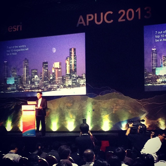
Leslie then introduced one of the region’s most progressive users of GIS technology – APUC’s keynote speaker – Chief Executive of the Singapore Land Authority, Mr Vincent Hoong.
Mr Hoong’s presentation was fascinating as it highlighted for me how fundamental GIS technology is across all facets of the work his agency undertakes.
He conveyed that geospatial analysis is a growth area not only for the SLA, but for all of Singapore. One example he gave of this is OneMap – SLA’s ‘one stop’ geospatial platform for agencies. When the platform launched in 2011, it featured 40 information types from 20 agencies. Today there are 69 information types sourced from 36 agencies.
Mr Hoong said key to this growth is the fact that geospatial content is now recognised by the Singapore Government as key for effective decision-making.
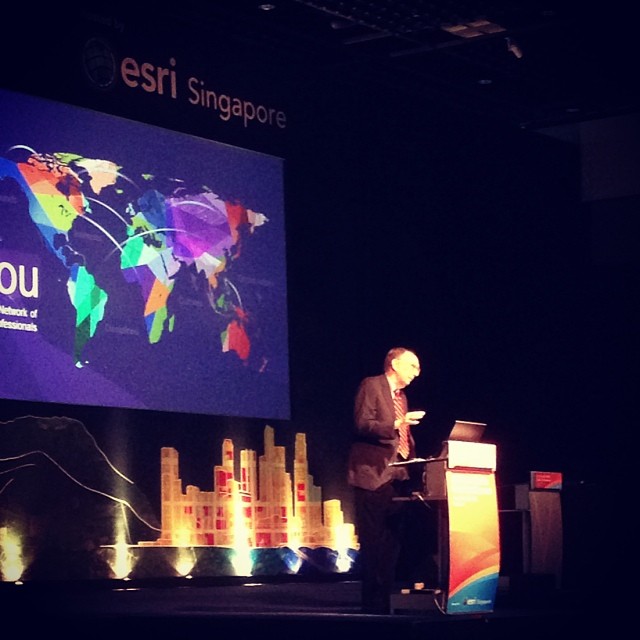
The other highlight from the plenary for me was – of course – the address from Esri Founder and President Jack Dangermond.
Jack started by reflecting on some of the great work being conducted in the Asia Pacific – from Australia, to the Philippines, and to Japan.
He then went on to discuss the evolving role of GIS and how it will be pivotal in securing a better future for the region. Our society is facing unparalleled challenges – he cited the effects of climate change as just one example.
He posed the question – will GIS keep up with the challenges of climate change? He said the simple answer is ‘yes’.
GIS is going through a transformation that will allow us to accelerate its use through society. Key to that is how traditional GIS is changing to become a ‘Web GIS’. That’s not just a Desktop GIS; not just a Server GIS; it’s an entirely new pattern. Web GIS leverages the Cloud, real-time data, big data – it integrates 2D into 3D.
Importantly, Web GIS supports two key user groups – traditional GIS users and the new business user (who Jack also calls knowledge workers). Through making geographic analysis more accessible to these new users through Web GIS, it will become pervasive to all that we do.
Finally – Jack gave us a sneak peek at what’s coming next with the technology – ArcGIS 11.
It’s going to be much faster – with 64 bit processing, it will be the fastest, most responsive spatial technology ever invented. It will have unified 2D and 3D viewing and there’ll also be composite feature creation – so users can create multiple features with a single click.

Sunday, June 5, 2016

ArcGIS 10.4 is here


ArcGIS 10.4 and the soon to be release of ArcGIS Pro 1.2 brings you new and improved capabilities for visualization and enterprise readiness ...

https://blogs.esri.com/esri/arcgis/2016/02/18/arcgis-10-4-is-here


ArcGIS 10.4 pre-release software is now available for qualified customers. This pre-release software will allow you explore and test a variety

If using a Concurrent Use license, you will need an ArcGIS 10.4.1 License Manager, which can be used for all ArcGIS 10.x Concurrent Use licenses.

System requirements for ArcGIS for Desktop, including supported operating systems, OS limitations, hardware and software requirements, and the license.

information for that specific area of the software. Geoprocessing. The following are new tools and changes to existing tools for ArcGIS 10.4. 3D Analyst toolbox.

Esri has released ArcGIS 10.4. Improvements and updates include the ability to author vector tile maps and layers using ArcGIS Pro and share

ArcGIS 10.4 has finally arrived (most of it). Esri announced last week that their flagship product suite, ArcGIS 10.4 is here.

Arcgis 10.3 Cracked (10.4 coming soon)

Depuis plusieurs années maintenant, Esri propose une approche complète visant à mettre en place une plateforme géospatiale: ArcGIS.  En version 10.3, la vision de cette plateforme reste globalement la même, organisée autour des 4 piliers de votre SIG..


Download Name
Date Added
Speed
Arcgis 10.3
30-Dec-2014
2,747 KB/s
Arcgis 10.3 (Dec/2014)
30-Dec-2014
2,264 KB/s
Arcgis 10.3 Cracked
29-Dec-2014
2,204 KB/s
Arcgis 10.3 Full
27-Dec-2014
2,517 KB/s
Arcgis 10.3 [verified]
27-Dec-2014
2,934 KB/s
Arcgis.10.3.Proper.rar
22-Dec-2014
2,186 KB/s
Arcgis 10.3 ISO
19-Dec-2014
2,778 KB/s
ArcGIS Desktop 10.1 X86x64
18-Sep-2012
2,246 KB/s
ArcGIS Engine Developer Kit V.10 ArcGIS Desktop 10 With Tutorial Data
18-Jul-2012
2,473 KB/s
ArcGIS Engine Developer Kit V.10 ArcGIS Desktop 10 With Tutorial Data
14-Jul-2012
2,111 KB/s


Arcgis 10.3 Cracked29-Dec-20142,204 KB/s